Caption: A political map of Mexico.
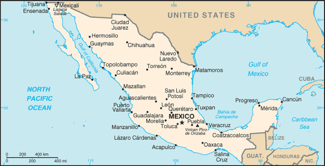
The Chicxulub crater (which is an impact crater) straddles the northern coast of the Yucatan Penisula with center just east??? of Progreso, Yucatan. It is centered near the village of Chicxulub. Yours truly believes Chicxulub is pronounced chick-shoe-lube.
The Chicxulub crater is ∼ 150 km in diameter and is the 3rd largest impact crater known on Earth (see Wikipedia: List of impact craters on Earth: Largest craters (10 Ma or more)). But it is entirely covered by sedimentary rock???.
The Chicxulub crater was discovered by finding shock-exposed rock and subsequent geological investigation.
The Chicxulub impactor hit ∼ 66 million years ago and caused the mass extinction at the end of the Cretaceous period (i.e., the Cretaceous-Paleogene (K-Pg) extinction event) that included the extinction of the dinosaurs.
How? The Chicxulub impactor may have touched off worldwide fires (perhaps firestorms, but that is debated: see Cretaceous-Palaeogene firestorm debate) and caused dust in that atmosphere that a multi-year winter (Se-574).
Keywords for the map: Bay of Campeche, Belize, Caribbean Sea, Central America Chicxulub, Yucatan, Chicxulub impact crater, Chicxulub impactor, Clipperton Island (not on map), Costa Rica (not on map), Cuba, El Salvador, Guatmala, Honduras, Gulf of California (Sea of Cortez) Gulf of Mexico, Isla de la Juventud (Cuba), Mexico, Mexico City, Nicaragua, North America, Pacific Ocean, Panama (not on map), Progreso, Yucatan, United States of America (USA), Yucatan.
-
Credit/Permission:
Central Intelligence Agency (CIA),
before or circa 2005
/ Public domain.
- You may have thought the
CIA
were spys,
but actually they make maps.
Yours truly thinks this explains a lot of things.
Download site direct: Perry-Castaneda Library Map Collection: Mexico Maps: Mexico (small map) 2016: Scroll down ∼ 5 % for an updated version of the displayed map Mexico (small map) 2016.
Image link: Itself.
Local file: local link: map_mexico_cia.html.
File: Maps file: map_mexico_cia.html.