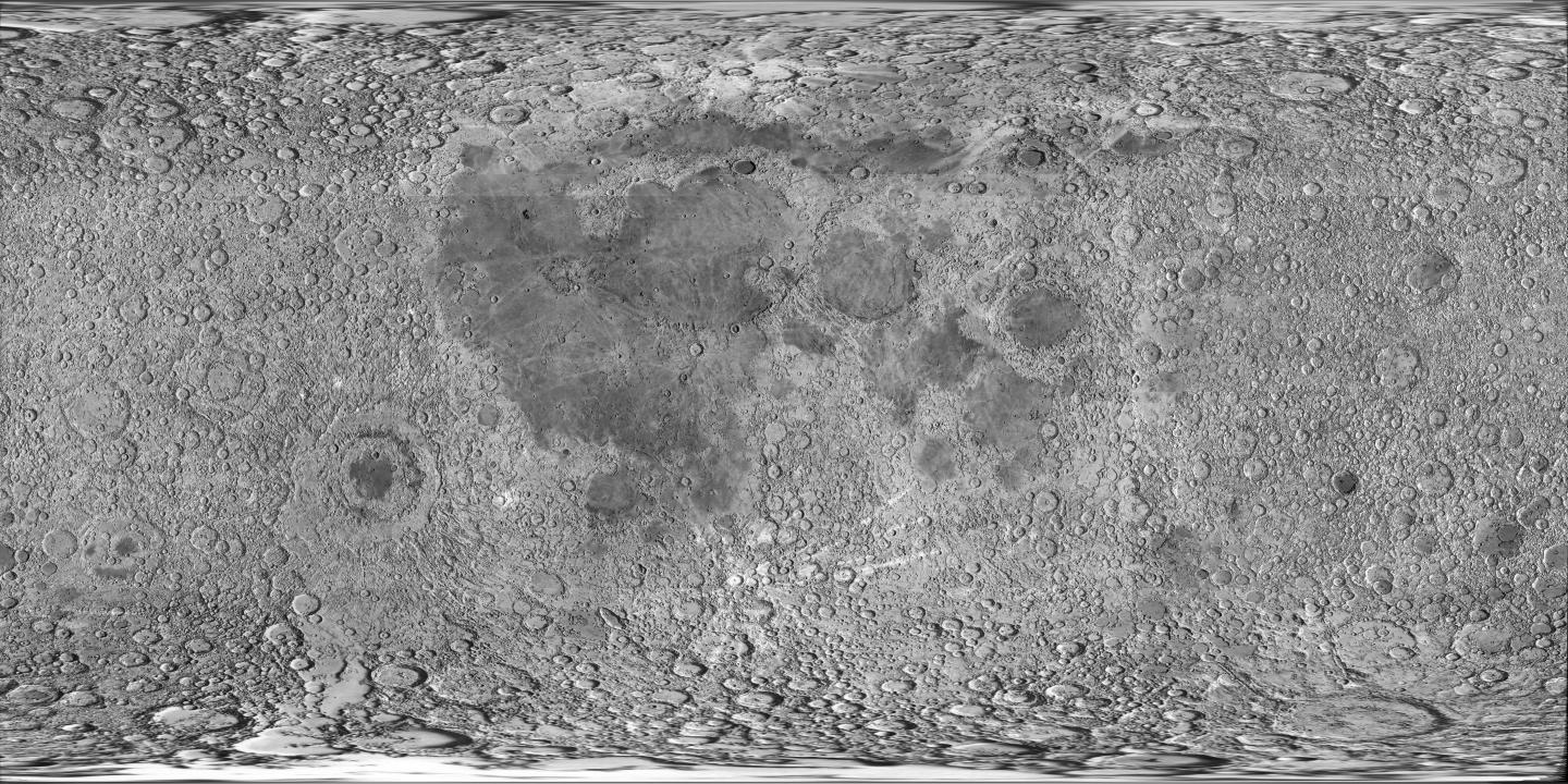
Caption: Mercator projection image Moon map.
Features:
- The near side is the central 50% zone.
The
far side is the left and right 25 % zones.
- The darker regions are the lunar maria
(singular lunar mare) which are the lowlands of
the Moon.
Everything NOT
maria is
the lunar highlands.
- Oceanus Procellarum is the
biggest mare.
Orientale Basin
is to the south-west of Oceanus Procellarum.
Mare Tranquillitatis is the hind
end (but not the tail or feet)
of the Leaping Moon Rabbit.
Mare Moscoviense
(the largest mare
on the far side)
is due east
of Mare Tranquillitatis and rather
inconspicuous.
- One can see the maria cover only a small part of the
lunar surface:
∼ 16 %
(see Wikipedia: Lunar mare).
However, they are concentrated on the
near side of the Moon
(where all the big ones are),
and so look more extensive than they are to
Earthlings.
- Mare
means sea in Latin.
Galileo (1564--1642),
himself suggested they were bodies of
water though he probably eventually realized they had to be plains
(HI-140).
The names of the maria
(at least the largest ones???)
on the near side of the Moon
were given by
Giovanni Battista Riccioli
(1598--1671)
(see
Wikipedia: Giovanni Battista Riccioli: Work concerning the Moon).
But the name mare is actually good. The mare are frozen seas of lava: they are lava plains and are dominated by basalt rocks: they are silicates rich in iron, manganese, and titanium (Se-451).
- For lists of Moon features, see
Wikipedia: List of lunar craters,
Wikipedia: List of lunar features,
Wikipedia: List of lunar maria,
Wikipedia: List of lunar mountains and mountain ranges.
Download site: JPL's map page, but at the hidden? JPL page, alas a dead link.
Image link: Itself.
Local file: local link: moon_map_mercator.html.
File: Moon map file: moon_map_mercator.html.