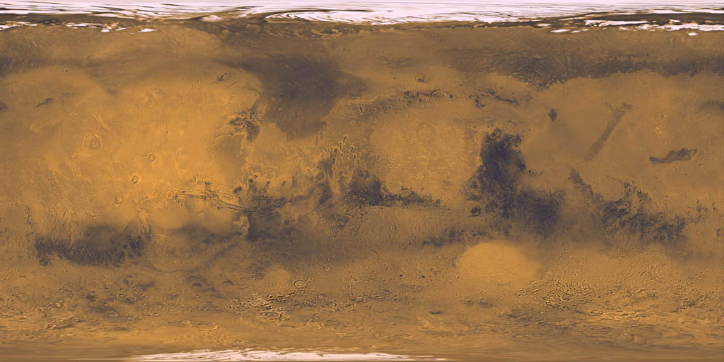
Image 1 Caption: A Mercator projection collage-image map of Mars in true color with Martian geography illustrated.
Features:
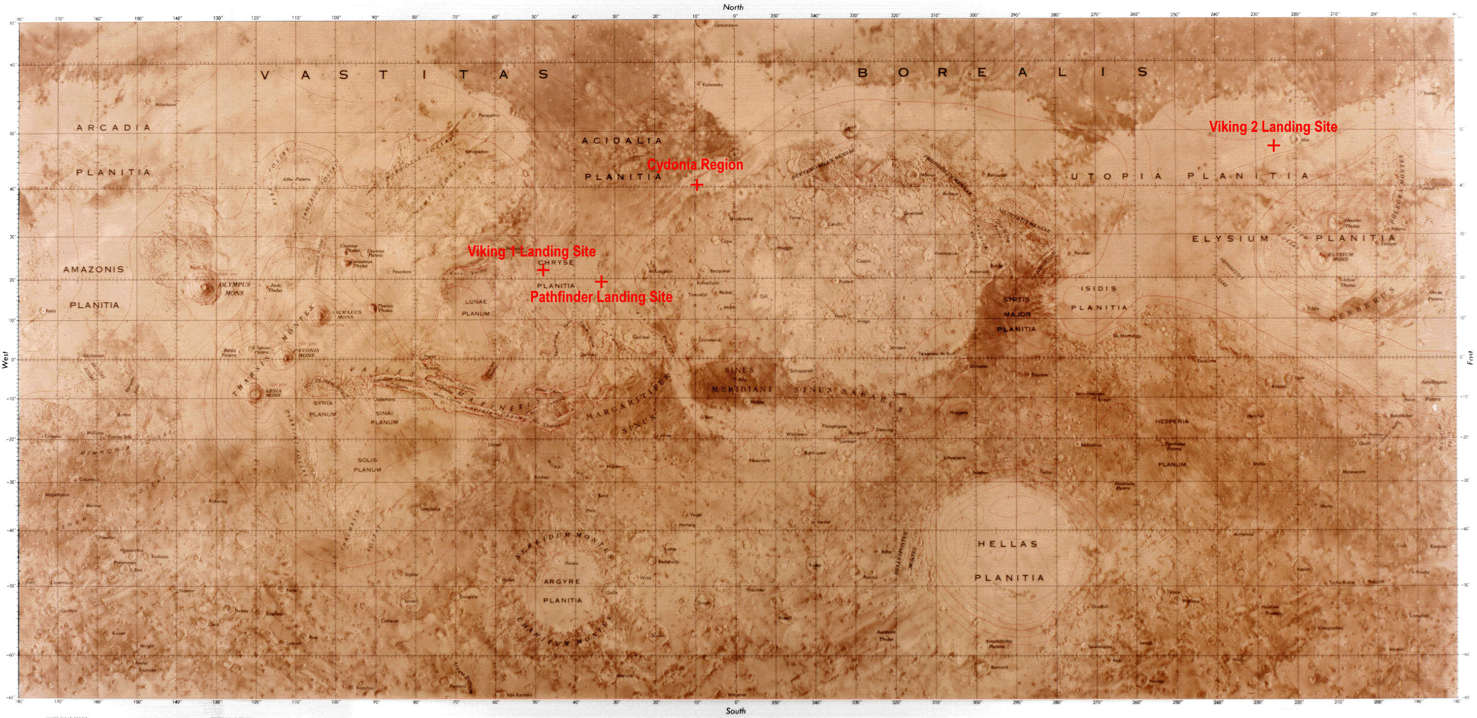
- Image 2 Caption: A Mercator projection
all-Mars
physical map
(also a topographic map)
with displayed
Martian geographic coordinates
and
geographic feature names.
But the geographic feature names
are in really small, inconspicuous print, unless you click on the image
and magnify.
- Zero longitude is in the center of both images.
- The large dark region in the eastern hemisphere (290° W) is
Syrtis Major
which is the most prominent dark region seen from
Earth and was
first identified by
Christiaan Huygens (1629--1695) in the
17th century.
- Crater Schiaparelli
is on the equator just east of zero longitude.
This impact crater
is named for Italian
astronomer
Giovanni Schiaparelli (1835--1910) who in
1877 concluded that
the Martian canals
were a major feature of Mars.
Actually, in calling them canali in Italian, he was NOT implying that they were artificial: his meaning was probably closer to the English channels (Se-477--478).
Schiaparelli did think they could be full of liquid water which was quite wrong.
- Valles Marineris is the "wry smile" stretching
over about 60°
and centered at about 90 W just below the equator.
The western hemisphere can most easily be identified by spotting Valles Marineris.
- West of Valles Marineris are three
volcanoes in a row and to
the west of those is Olympus Mons,
the largest known
volcano in the
Solar System.
These volcanoes are all in the Tharsis region: this is a giant dome or bulge or plateau that is, perhaps, above a giant mantle plumes that has forced it up and given rise to the region's strong volcanism (HI-190--191).
The Tharsis region may be something like coronae of Venus (HI-191).
- Hellas Planitia is a
basin centered at about 40 S, 70 E.
It is low, circular region probably formed by a
impactor
similar to the ones that formed the
Orientale Basin
on the Moon
and the Caloris Basin
on Mercury????
(HI-199).
- Note the southern hemisphere looks more heavily cratered than
the northern hemisphere.
-
Question: If the collage-image map
is accurate, what hemisphere is experiencing winter?
- The northern hemisphere.
- The southern hemisphere.
- The eastern hemisphere.
- The western hemisphere.
Answer 1 MAY be right.The north polar cap of Mars has a residual summertime diameter of about 1000 km. The south polar cap of Mars has a residual summertime diameter of about 350 km.
The polar caps expand in the winter due to CO_2 ice deposition and contract in the summer due to CO_2 ice sublimation.
The intrinsic size difference between the polar caps makes it hard without detailed information to know what season our collage-image map comes from.
-
Images:
- Credit/Permission: NASA,
USGS,
before or circa 2003 /
Public domain.
Download site: Views of the Solar System by Calvin J. Hamilton