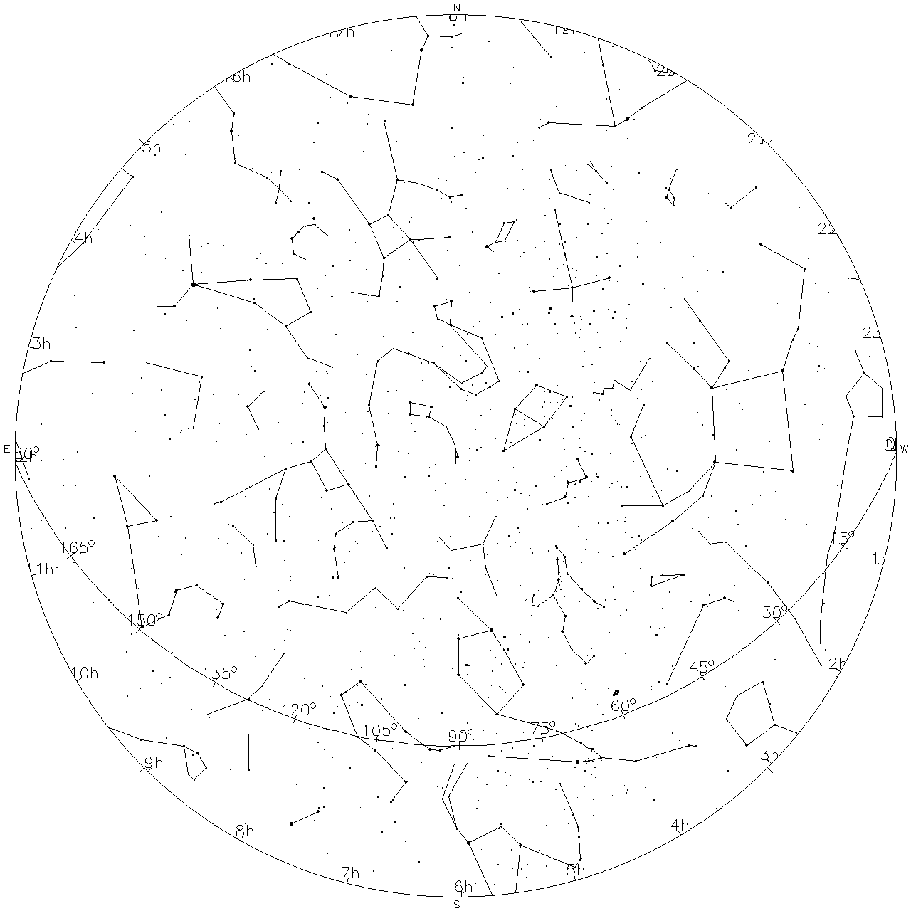
Caption: Sky map for the North Pole sky on the winter solstice at midnight. Click on the image to get square polar-sky pdf sky map which is NOT for the same time.
Features:
- The horizon is the
circumscribing circle.
- Since we are at the North Pole
(90° north latitude),
the celestial equator
coincides with the horizon.
- Also since we are at the North Pole,
we are in the middle of the 6-month night.
- The equatorial coordinate
right ascension (RA) increases
going east along the celestial equator
from its zero point vernal equinox.
The vernal equinox
is both the point where ecliptic
crosses the celestial equator
and also the event when the
Sun traveling along the
ecliptic
crosses the celestial equator.
- The vernal equinox happens on about
Mar21.
- Right ascension is given in the
funny angle units of hours: 1 hour = 15°.
- The equatorial coordinate
declination (Dec) is measured
from the celestial equator
along
great circles that pass through
the
north celestial pole (NCP)
and south celestial pole (SCP).
- Because we are the North Pole,
the NCP is at
zenith.
- The ecliptic is the curve crossing
the lower part of the sky map.
The ecliptic is the path of the Sun on the sky. The Sun completes the path in one solar year.
- The ecliptic coordinate system
longitude
(which is measured along the ecliptic itself as shown)
is also measured from the vernal equinox going
eastward, but in degrees.
Image link: sky_map_unlabeled_polar.pdf.
File: Sky map file: sky_map_north_pole_2013_12_21_23.59.59.html, sky_map_north_pole_2013_12_21_23.59.59.gif.