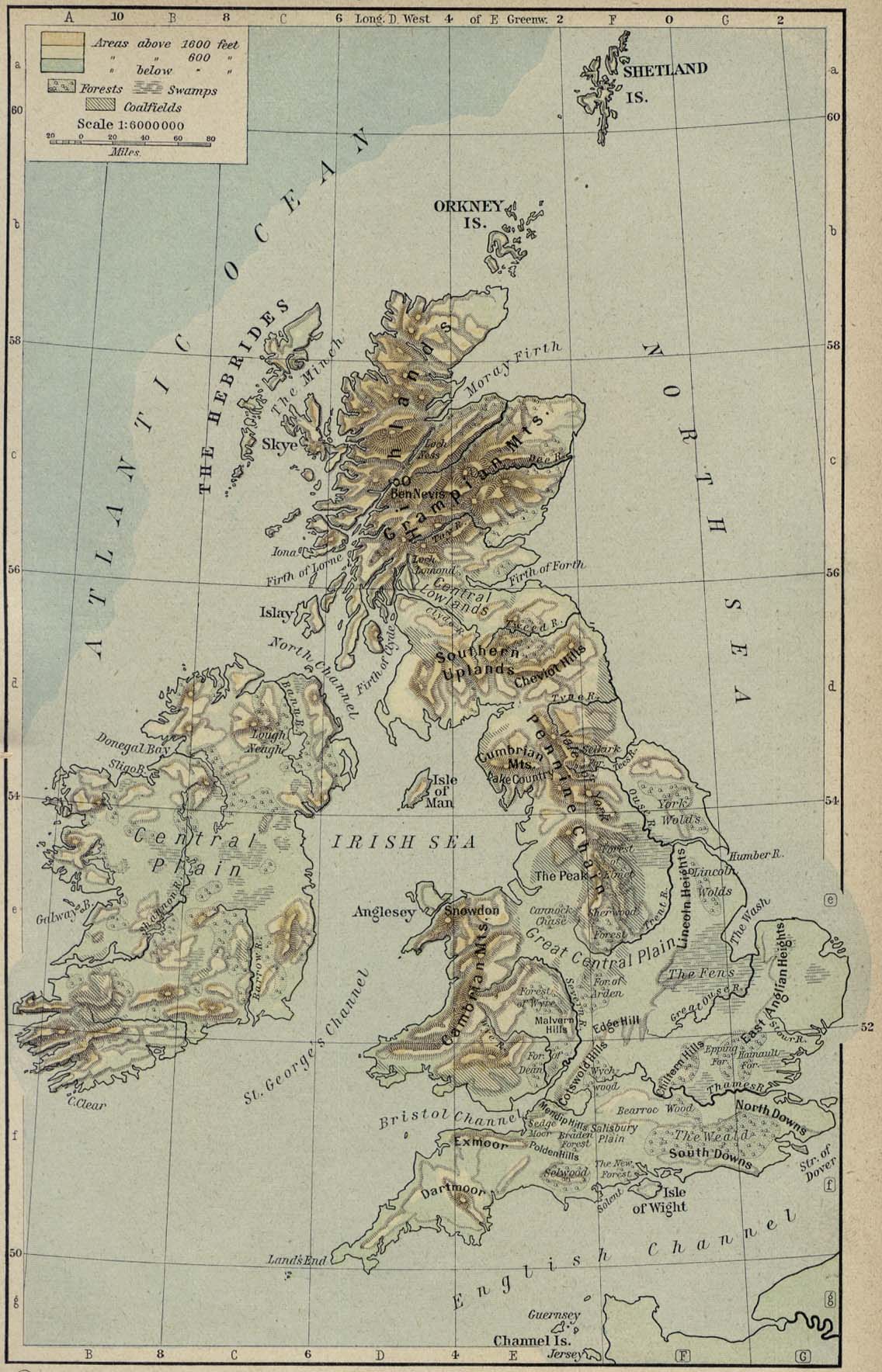
 Figure: Physical maps of the Hiberno-British Isles
Image 1 Caption: A physical map of the British Isles---or, patriotically speaking, the Hiberno-British Isles (see Wikipedia: British Isles naming dispute).
Stonehenge is in southwest England on the Salisbury Plain.
Selected locations: including cathedrals, cities, counties, geographical features, islands, landmarks, political divisions, towns, tourist sights, et cetera:
- Derry (county): Bann (river), Coleraine, Derry (city), Fermullan (modernly Formullen).
- Dublin: Liffey (river), St Stephen's Green, Trinity College, Dublin.
- Galloway: maps: Galloway: schematic (1931) for The Five Red Herrings (1931), Galloway: schematic (1931) from The Five Red Herrings (1931) (best online version), Galloway: physical, etc.
- London: House of Lords Library, Thames (river).
- Somerset: Cadbury Castle, Church of St John the Baptist, Glastonbury, Glastonbury, Glastonbury Abbey, Glastonbury Lake Village, Glastonbury Tor, Mendip Hills, Sedgemoor, Somerset Levels, The Tribunal, Glastonbury, Wells, Somerset, Wells Cathedral, Yeovil.
- Wiltshire: Salisbury Cathedral, Salisbury Plain, Stonehenge.
- Yorkshire: Aysgarth, Aysgarth Falls, Coverhead (source of the River Cover), Rievaulx Abbey, York, Wensleydale.


.jpg)
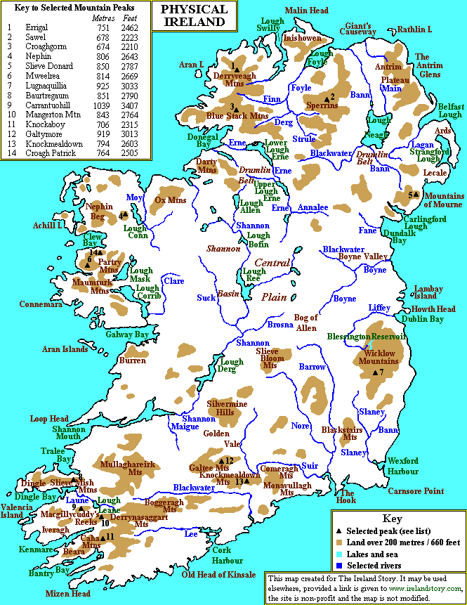
Image 2 Caption: A physical map of Ireland.
Image 3 Caption: A physical map of Ireland.
Credit and/or file tracking information follows to the divider line:
Images:
Local file: local link: map_british_isles_physical.html.
Image links in order of increasing directness:
(1) Perry-Castaneda Library Map Collection,
(2) Perry-Castaneda Library Map Collection: Historical Maps,
(3)
Historical Atlas (1923,1926),
William R. Shepherd (1871--1934),
(4)
Physical Map of the British Isles (296K) [p.49] [1926 ed.]:
scroll down ∼ 20% in "(3)".
Image link: Wikimedia Commons:
File:Ireland - Terrain and transportation (1961).jpg.
File: Maps file:
map_british_isles_physical.html.
![Physical Map of the British Isles (296K) [p.49] [1926 ed.]](https://maps.lib.utexas.edu/maps/historical/shepherd/british_isles_ref_1926.jpg)