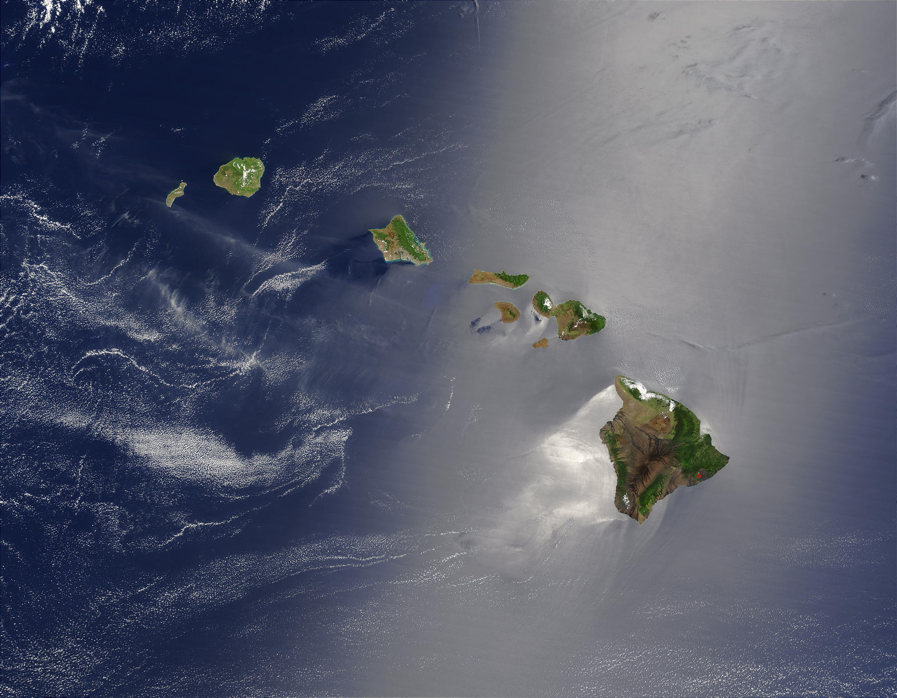
Image 1 Caption: A satellite image in true color of the Hawaiian Islands from the Terra satellite (1999--).
The Big Island is obvious. Oahu (with Honolulu with Pearl Harbor) is the 3rd island from the left.
 Image 2 Caption: "A diagram showing the
Hawaii hotspot and the
inferred underlying mantle plume
in cross section."
(Slightly edited.)
Image 2 Caption: "A diagram showing the
Hawaii hotspot and the
inferred underlying mantle plume
in cross section."
(Slightly edited.)
The Hawaii hotspot is ∼ 500 km wide (see Wikipedia: Hawaii hotspot: Characteristics), and so extends well beyond the Big Island (size scale 60 km) which is where most of the active volcanism occurs.
The tallest Hawaiian volcano is Mauna Kea which is considered dormant, but it will probably erupt again (see Wikipedia: Mauna Kea: Future activity). Mauna Kea is in fact one of the world's best observing sites for astronomy (probably the best in the Northern Hemisphere) and is the location for the Mauna Kea Observatories.
See Hawaii hotspot keywords below/at link:
-
Hawaii hotspot keywords
(i.e., Hawaii hotspot
keywords):
asthenosphere,
Big Island (formally Hawaii Island),
Hawaii,
Hawaii hotspot,
Hawaiian-Emperor seamount chain,
hotspot,
Kauai,
Kilauea,
List of Hawaiian-Emperor seamount chain volcanoes,
lithosphere,
mantle plume,
Maui,
Mauna Kea,
Mauna Kea Observatories,
Mauna Loa,
Molokai,
Niihau,
Oahu,
Pacific Ocean,
Pacific plate,
seamount,
volcanism,
volcano,
etc.
See Volcano videos below (local link / general link: volcano_videos.html):
EOF
Images:
Local file: local link: hawaii_hotspot.html.
Download site: NASA: Visible Earth.
Image link: Itself.
Image link: Wikimedia Commons:
File:Hawaii hotspot cross-sectional diagram.jpg.
File: Earth geology file:
hawaii_hotspot.html.