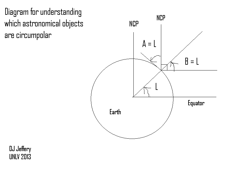
Caption: A diagram illustrating how to determine the altitude of the north celestial pole (NCP).
Features:
- This is a cross-sectional view of the Earth.
- The Earth's axis is extended to the north celestial pole (NCP) and the Earth's equator is projected outward to the celestial equator.
- The NCP and celestial equator are infinitely remote, and so any lines parallel to lines going to these things also go to them.
- L is value of the latitude of a general observer on the Earth's surface. It's NOT 45° or any specific angle---it just looks that way.
- The observer is tiny and so the Earth's surface to him/her is an infinite plane cutting the celestial sphere in half---the cut line is the horizon.
Credit/Permission: © David Jeffery,
2013 / Own work.
Image link: Itself.
Local file: local link: ncp_altitude_circumpolar.html.
File: Celestial sphere file:
ncp_altitude_circumpolar.html.