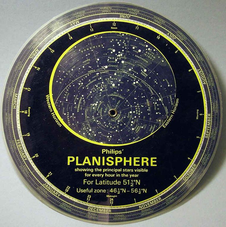
Caption: Planisphere for the Northern Hemisphere.
Features:
- The planisphere is a
descendant of the ancient astrolabe.
- It is a kind of analog computer
if one uses the word computer very broadly.
- NOT all planispheres
look like the one in figure, but there are basic similarities.
- Our astrononomy laboratory
planispheres
(at UNLV)
have a square overlay and a square base.
These planispheres are usually held
in "diamond" orientation, NOT "square" orientation, with
north at the top.
- On the overlay are the ordinary
hours of the 12-hour clock:
am on the left,
pm on the right.
- There is rotating circular sky map
on an axis sandwiched between the overlay and the base.
The axis is the north celestial pole (NCP).
- The sky map has the days of year
marked around its outer edge.
- You rotate the sky map until, the
day of the year for which you want to know the sky
aligns with the clock time for which
you want to observe the sky.
You could do this for right now: .
- In the oval window of the overlay, you see approximately the sky
for that day and time.
The edge of the oval is approximately the horizon.
-
North is at the top of the oval,
south is at the bottom.
East is the left, west is on the right.
A day passes, objects rise on the east of the oval and set on the west.
Northern circumpolar objects never go below the horizon: they just rotate counterclockwise about the NCP.
-
A planisphere is
designed only for a specified range of
latitudes.
It will NOT show all the sky above the horizon outside of that range and if you are too far out, none of the sky above the horizon.
A planisphere does show all the sky above the horizon for its specified range because the oval is set to show more sky than the horizon allows.
- Our planispheres
are for 40° north latitude
and for that latitude
show the sky to about -50°
declination (Dec or δ)
and to about 40° below the
NCP
in the direction of the northern horizon
(see bottom of page 4 of the instructions).
- So our planispheres
are about right for Las Vegas, Nevada
which has coordinates 36° 10' 30" N, 115° 08' 11" W
(memorable fiducial values 36° N, 115° W).
Image link: Wikipedia.
Local file: local link: planisphere.html.
File: Celestial sphere file: planisphere.html.