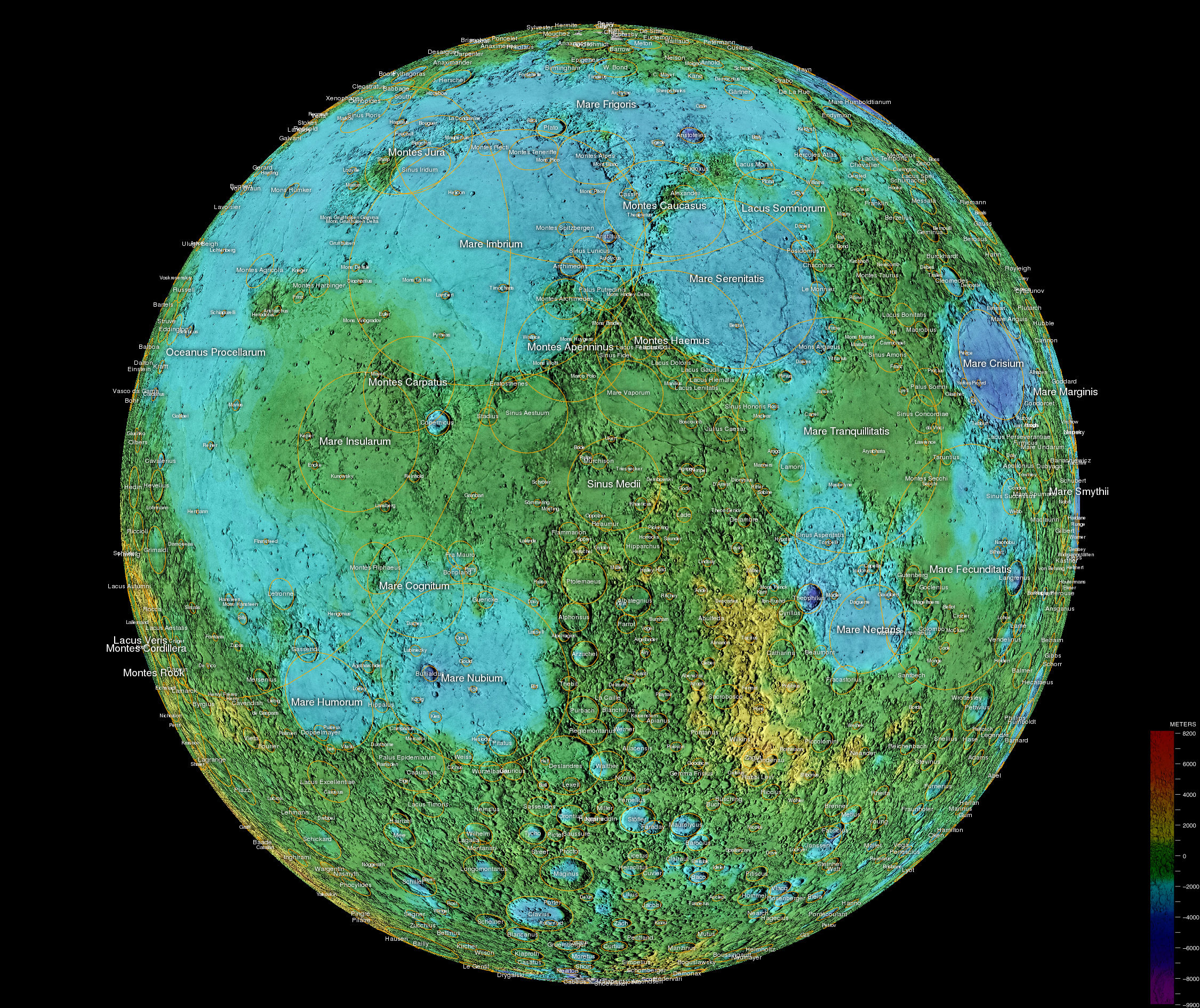
Caption: Moon Map: "Upright, correct image, USGS color-coded, grid: 1800x1800."
Features:
- This may be the semi-great online
public domain
Moon map of
near side of the Moon.
- Many of the Moon's
geological features
are named and yellow lines are used to delineate many of the more prominent features.
- The image has a zoom-in mode when viewed in its own
window which can
be seen by clicking on the image.
- The maria
are delineated by lines since the colors give elevation,
not the surface
true color.
But you note tha the maria are the lowlands of the Moon and the rest of the Moon is lunar highlands
- An inconvenience of this map is that it does NOT show the rays of the
rayed craters.
As a result, some lunar craters which are obvious when viewing the Moon or in images of the Moon look rather inconspicuous.
For example, craters Tycho and Kepler stand out when viewing images, but on this map you have to hunt around for them.
Tycho is in the south, north of the bigger Crater Clavius.
Download site Android lunar maps by Alexander Pruss.
Image link: Itself.
Local file: local link: moon_map_side_near_topographic.html.
File: Moon map file: moon_map_side_near_topographic.html.