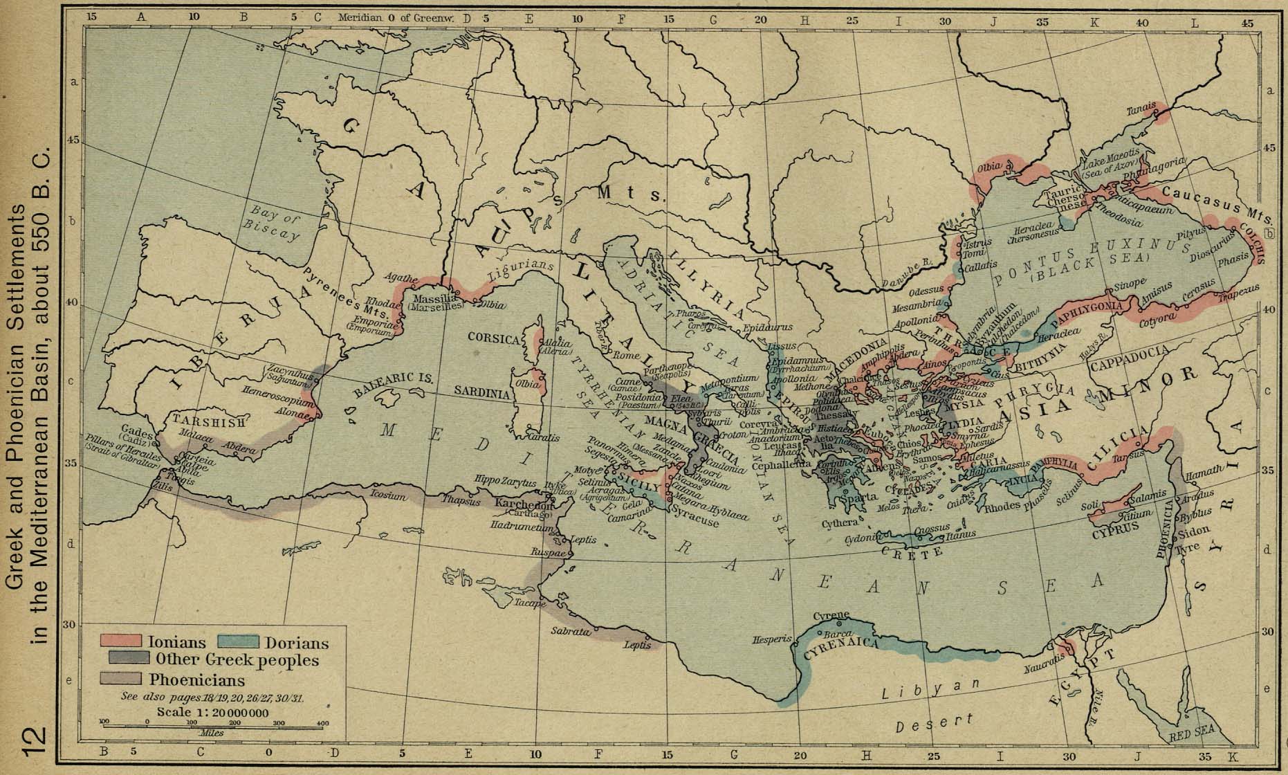
Caption: Ancient Greece (which includes the Greek colonies) and Phoenicia and the Phoenician colonies in the Mediterranean Basin, about 550 BCE.
Click on the map for a larger version.
The ancient Greeks called their country Hellas and themselves Hellenes----and why don't we just do that?---blame the Romans---see Wikipedia: Name of Greece.
Selected locations: including cities, geographical features, islands, landmarks, poleis, political divisions, temples, tourist sights, towns, et cetera, with associated favorite persons of Classical Antiquity (AKA Greco-Roman Antiquity):
Credit/Permission:
Willliam R. Shepherd (1871--1934),
Historical Atlas (1923,1926) /
Public domain.
Image links in order of increasing directness:
(1) Perry-Castaneda Library Map Collection,
(2) Perry-Castaneda Library Map Collection: Historical Maps,
(3)
Historical Atlas (1923,1926),
William R. Shepherd (1871--1934),
(4)
Greek and Phoenician Settlements in the Mediterranean Basin, about 550 B.C. (350K) [p.12] [1926 ed.] :
scroll down ∼ 10% in "(3)".
Local file: local link: map_hellas_circa_550_BCE.html.
File: Maps file:
map_hellas_circa_550_BCE.html.
![Greek and Phoenician Settlements in the Mediterranean Basin, about 550 B.C. (350K) [p.12] [1926 ed.]](https://maps.lib.utexas.edu/maps/historical/shepherd/greek_phoenician_550.jpg)