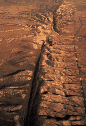
San Andreas Fault.
This is an aerial view of the San Andreas fault splitting Carrizo Plain in the Temblor Range east San Luis Obispo, California.
The San Andreas Fault is one of the relatively few places where a plate boundary crosses land. Lower California is will one day become an island.
For more information on the San Andreas Fault see USGS The San Andreas Fault site
Credit: U.S. Geological Survey (USGS): photographer Robert E. Wallace, USGS. USGS images are mostly public domain.