- Aegean Sea maps:
- Aegean Bronze Age: Pretty good and prints without pixelization.
- Aegean Ionia-Archaic Age:
- Aegean Iron-Archaic Age: Pretty good and prints without pixelization.
- Aegean Sea and Island map
- Ancient Hellas:
- Argolis
- Athens, Acropolis
- Athens, Agora: Better is Athens, Agora.
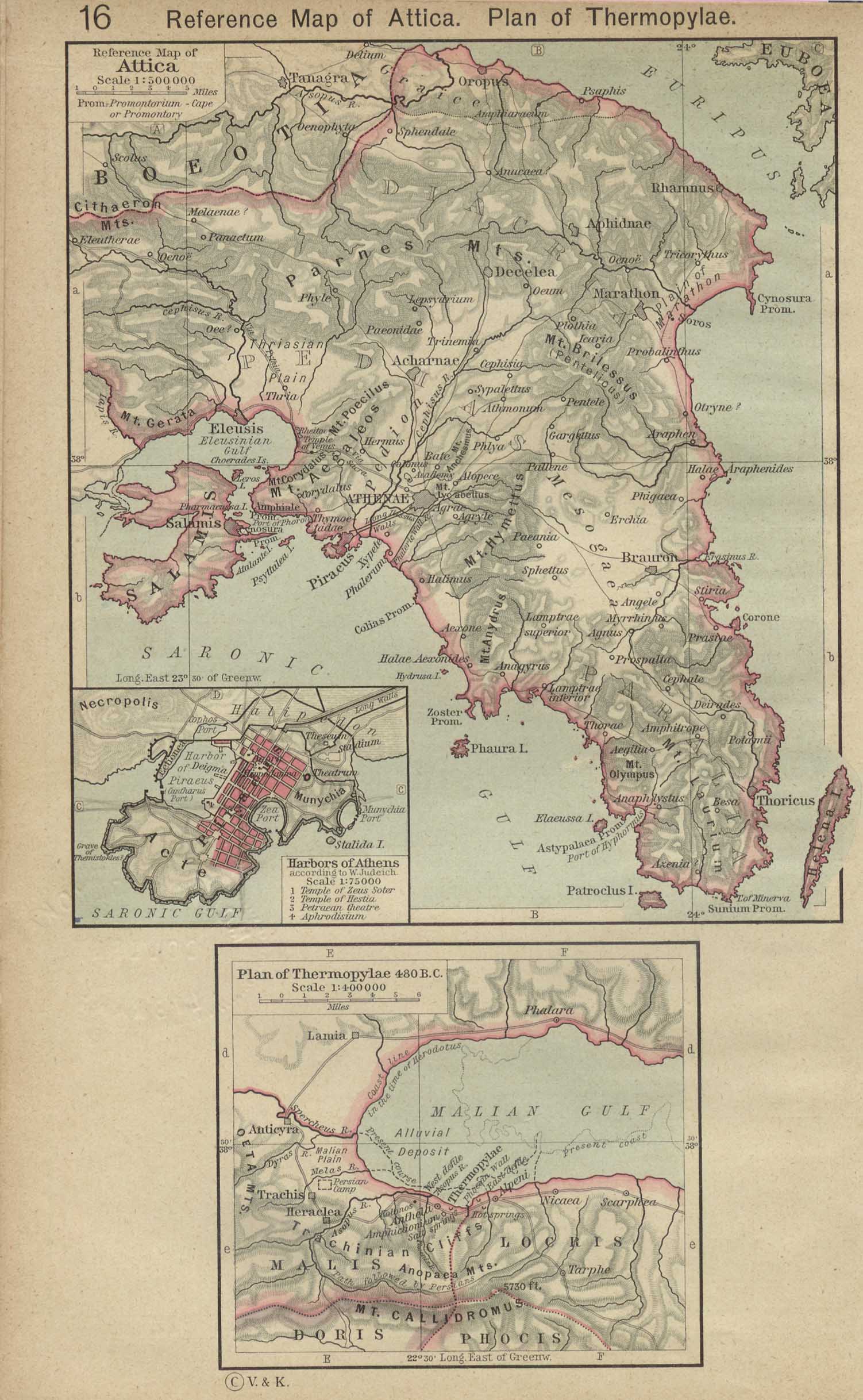
- Athens, Attica: but better is Athens, Attica and also Attica and Thermopylae 480 BCE (Shepherd 1923).
- Athens, Empire
- Northern Eastern Hellas: Title: A history of the ancient world, for high schools and academies, 1904, George Stephen Goodspeed 1860--1904.
- Southern Hellas: Title: A history of the ancient world, for high schools and academies, 1904, George Stephen Goodspeed 1860--1904.
- Western Hellas: Title: A history of the ancient world, for high schools and academies, 1904, George Stephen Goodspeed 1860--1904.
- Arcadia
- Boeotia
- Corcyra map
- Hesiod's cosmology and Homer's world
- Homeric Greece: Odyssey map.
- Ithaca
- Lesbos
- Olympia Sanctuary
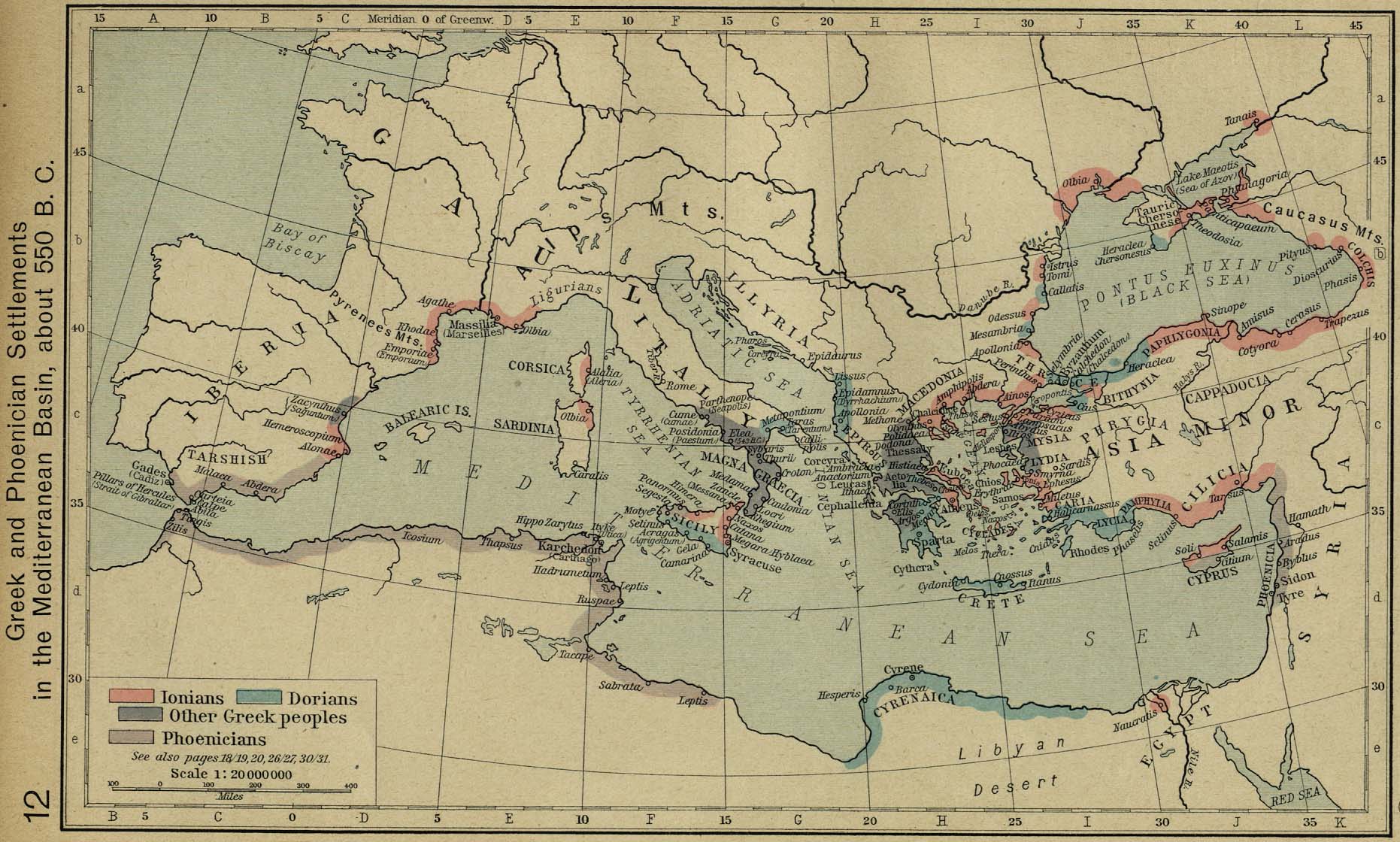
- Greek and Phoenician colonies c.550 BCE (Shepherd 1926).
- Corcyra map: Maybe OK.
- Etruria, Latium, Rome City maps:
- Etruria: Cities and some physical. Maybe OK.
- Eturia and Latium: Title: A history of the ancient world, for high schools and academies, 1904, George Stephen Goodspeed 1860--1904.
- Latium: May be best.
- Le Guin's Latium: More streams.
- Virgil's Latium: Maybe OK, not all the streams are shown.
- Pompeii
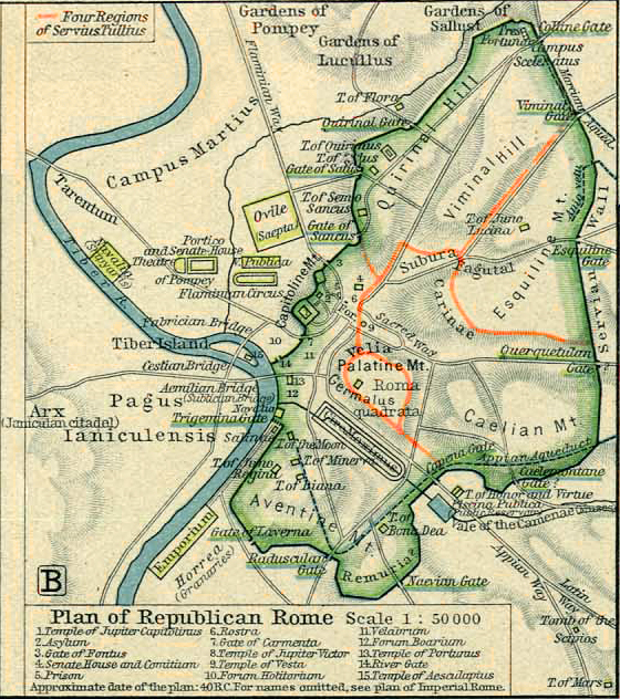
- Rome: Republican era: Looks OK.
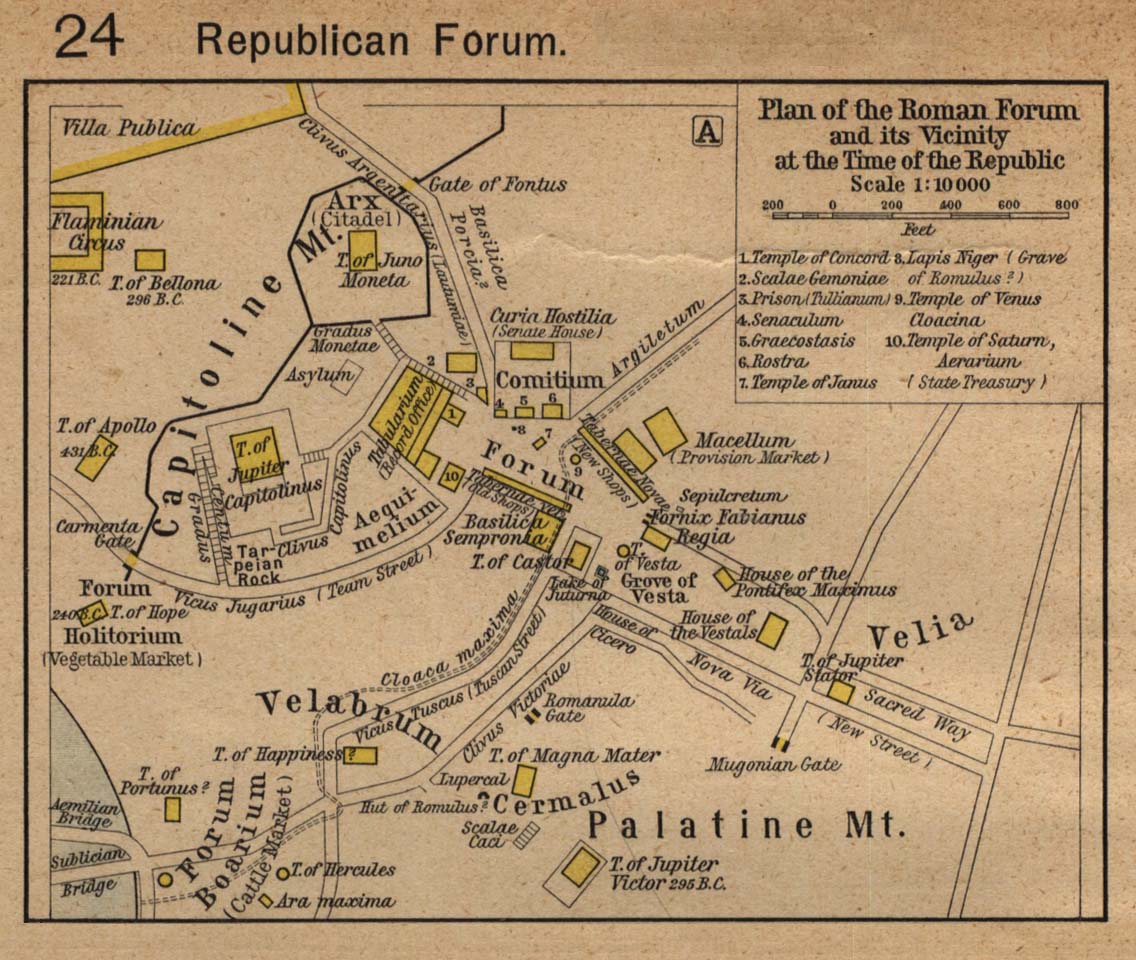
- Rome: Republican era: Forum (Shepherd 1923): Looks OK. Shows Lacus Juturnae, the shrine of Juturna. See also Rome: Republican and Empirial eras: Forum (Shepherd 1923):
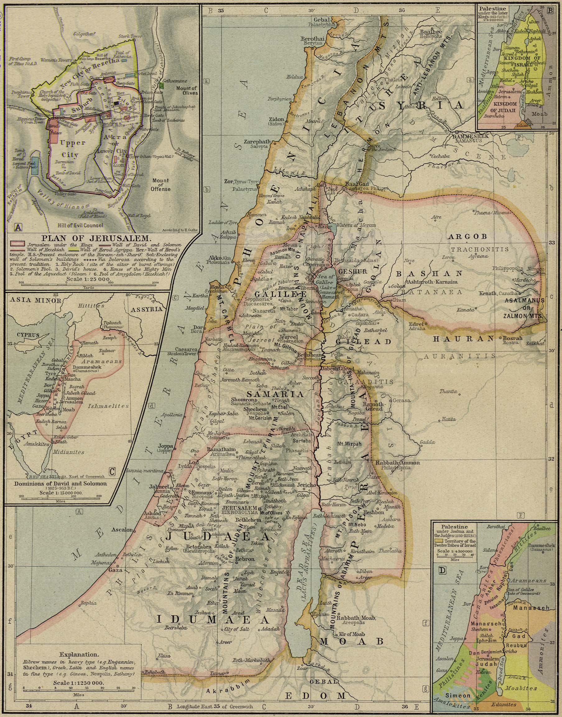
- Canaan:
- Ancient Canaan (Shepherd 1926)
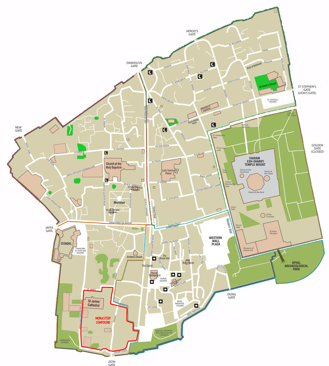
- Jerusalem, old city
- Melos: Maybe OK. Melos: Sailing map.
- Minoan Crete:
Pretty good and prints without
pixelization.
More place names are on
Karfi, Crete.
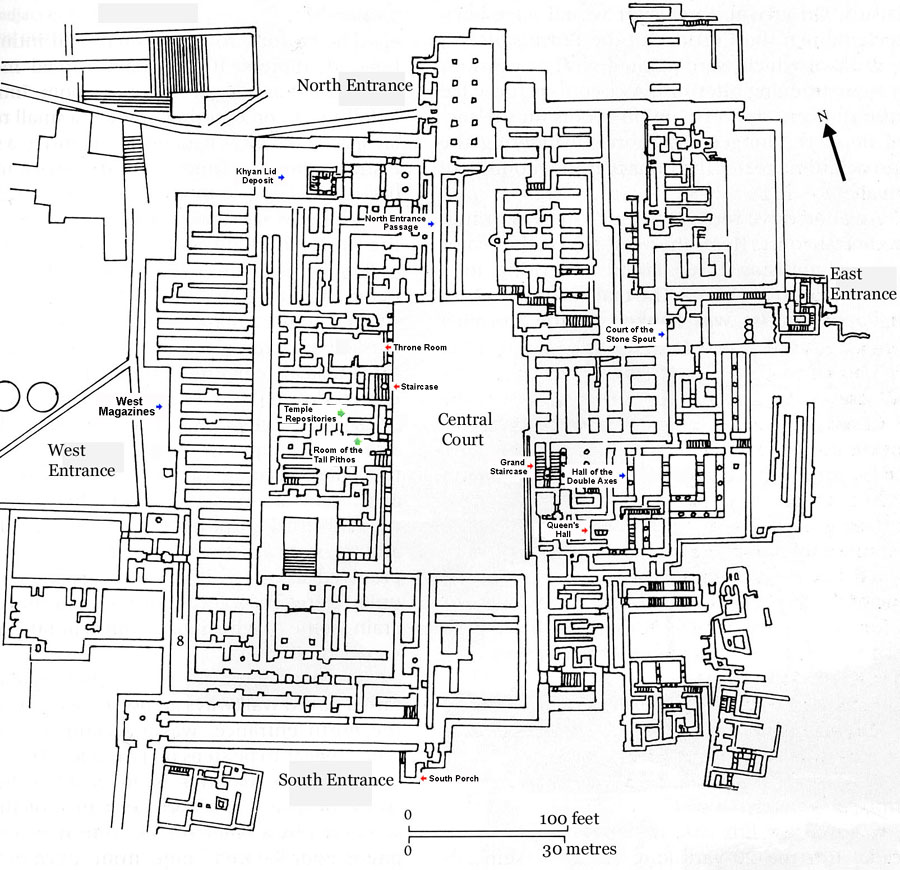
- Knossos map: Seems OK. see Bronze Age Architecture on Crete c.1500-1100 BCE for more maps.
- Knossos: Maybe better.
- Mycenae map: Maybe OK.
: Maybe better with different views.
- Pylos map: Maybe OK
- Thera: physical and sites: Maybe OK.
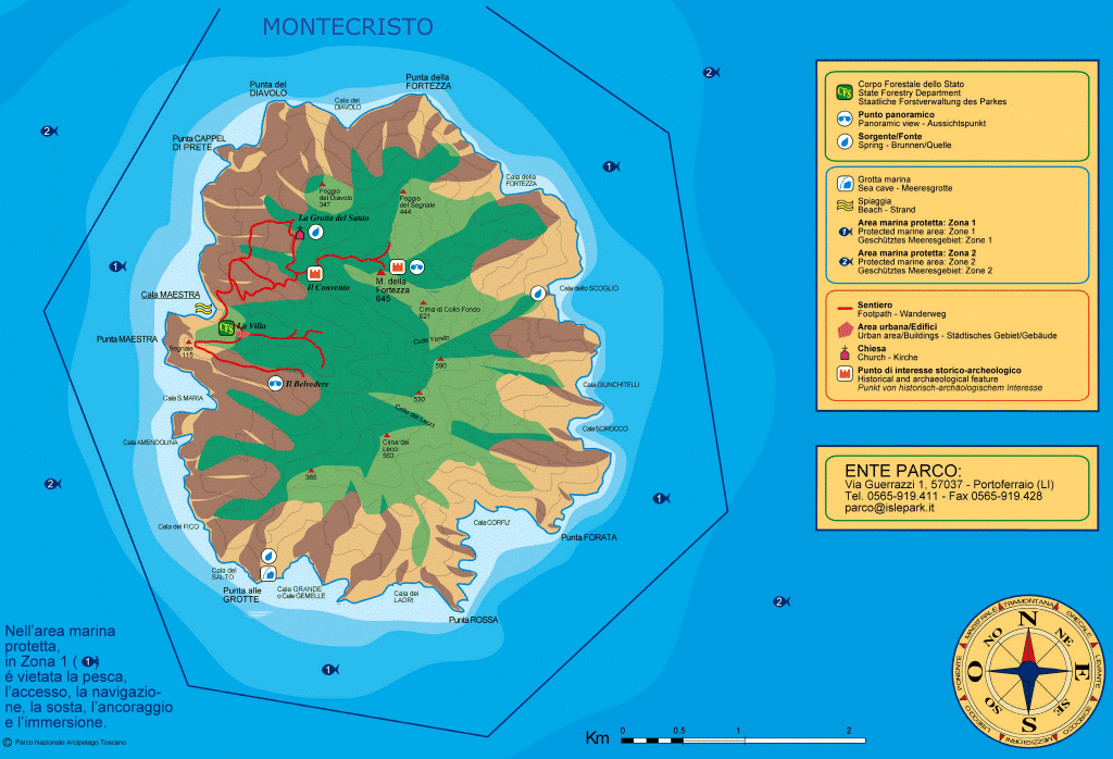
- Tuscan archipelago: Maybe OK.
- Ancient World Mapping Center at the University of North Carolina, Chapel Hill. The maps may be reproduced and redistributed freely for non-profit, personal or educational use only. It is not clear whether one can post them at one's own site. They are copyright protected.
- Perry-Casta~neda Library Map Collection. An excellent site for public domain maps. Lots come from the CIA---and you thought they were spies: actually they make maps---this explains a lot of things I think.
ImagesSome of the images are now broken links. I've come to the conclusion that without some clear statement of permission to use or of public domain status, I've no clear right to show those images. The images linked by thumbnails are legitimate to use for personal educational purposes with credit or are public domain. Credit and link to the source are given or are given by the thumbnail links.
-
 Dante & Virgil in Hell.
-
 Italy circa 1494.
Italy circa 1494. 1494 was the year Charles VIII of France (1470--1498; reigned 1483--1498) invaded Italy and upset the early Renaissance state system of Italy. Note that Cefalu is on the map.
Credit: Willliam R. Shepherd, 1923 Historical Atlas (now public domain). Download site Perry-Casta~neda Library Map Collection. An excellent site for public domain maps.

_(14590777280).jpg)
_(14777137942).jpg)
_(14591005757).jpg)
_(14777203892).jpg)