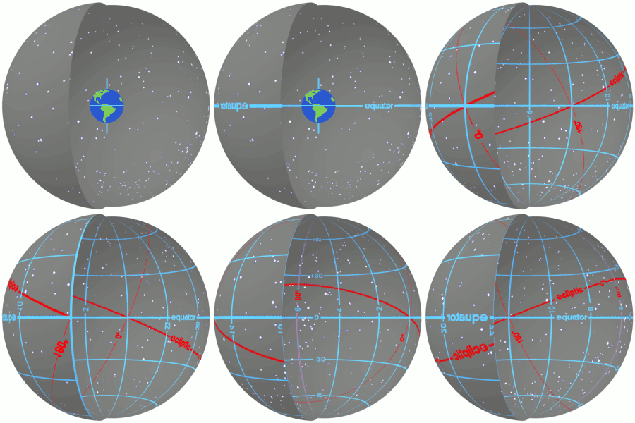
Caption: An animation illustrating the celestial sphere, the equatorial coordinate system, right ascension (RA), declination (Dec or δ), the north celestial pole (NCP), the south celestial pole (SCP), the celestial equator, the vernal equinox (0 h RA) (AKA First Point of Aries), the ecliptic, and the locations of stars Aldebaran and Sirius.
Features:
-
The
equatorial coordinate system
is essentially a
projection (as viewed from the
center of the Earth) of the
geographic coordinate system
onto the celestial sphere.
Longitude transforms to right ascension (RA) and latitude transforms to declination (Dec or δ), mutatis mutandis.
- Right ascension (RA) is
measured eastward from the
vernal equinox
in
hours (h) = 15°,
minutes (m) = 1/4 °,
and
seconds (s) = 1/60 m = 1/240 °.
- Declination (Dec or δ)
is measured from
celestial equator in
degrees (°),
arcminutes (') = 1/60 °,
and
arcseconds ('') = 1/60 '
= 1/3600 °.
Declination to the
north/south
is counted as positive/negative.
- The equatorial coordinate system
is tied to location of the Earth
and the
Earth's rotation axis
and the Earth's equator.
- Why is equatorial coordinate system good?
- The Earth is our observation platform: so it should
be at the center---any other center for an angular coordinate system would be very awkward for locating
astronomical objects for observations.
- The Earth's rotation spins us around
once per
sidereal day = 86164.0905 s
= 1 day - 4 m + 4.0905 s (on average),
and so all
points
on the celestial sphere
move X in
units
of right ascension
in X units
of sidereal time.
For example, if an astronomical object (one unmoving on the celestial sphere) is 3 hours east of the meridian, it will transit the meridian in 3 sidereal hours (which is just a bit less than 3 metric hours).
-
EOF
- The horizontal coordinates of an object vary with time and location on the Earth, and so CANNOT be used for standard locations in catalogs, etc.
- The horizontal coordinates of an object vary with time and location on the Earth, and so CANNOT be used for standard locations in catalogs, etc.
- The Earth is our observation platform: so it should
be at the center---any other center for an angular coordinate system would be very awkward for locating
astronomical objects for observations.
- So the
equatorial coordinate system
is observationally convenient and that's why it's good.
Image link: Wikipedia: File:Ra and dec demo animation small.gif.
Local file: local link: celestial_sphere_animation.html.
File: Celestial sphere file: celestial_sphere_animation.html.